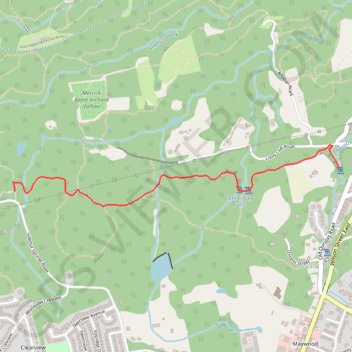
Sherman Falls - Canterbury Falls - Bruce Trail
Dundas Valley Conservation Area. #Hike #DundasValley
- Distance: 5.6 Km
- Elevation gain: 130 m
- Maximum elevation: 191 m
- Elevation loss: 130 m
- Minimum elevation: 157 m
Interactive map
GPS track profile
About this GPS track
Name: Sherman Falls - Canterbury Falls - Bruce Trail GPS track, route, trail
Coordinates: 43.23602 -79.99830 43.23947 -79.97294
Other GPS tracks
Click on a GPS track to view route, its statistics and profile.
Heritage Trail - Dundas Valley Conservation Area
#Hike #MTB #DundasValley
Distance: 4.5 Km • Elevation gain: 89 m • Maximum elevation: 215 m
Tiffany Falls - Sherman Falls - Lower Little Falls
Dundas Valley Conservation Area. #Hike #DundasValley
Distance: 3.7 Km • Elevation gain: 126 m • Maximum elevation: 201 m