Import a GPX file

Lake Louise

Banff National Park. #Hike #Run #Banff

  • Distance: 4.6 Km
  • Elevation gain: 37 m
  • Maximum elevation: 1,747 m
  • Elevation loss: 37 m
  • Minimum elevation: 1,735 m

Interactive map

GPS track profile

About this GPS track
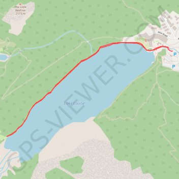
Other GPS tracks

Click on a GPS track to view route, its statistics and profile.

Lake Louise - Big Beehive - Plain of Six Glaciers

Canada > Alberta > Division No. 15

Banff Nationl Park. #Hike #Loop #Banff

Distance: 14.4 Km • Elevation gain: 826 m • Maximum elevation: 2,259 m

Lake Louise - Plain of 6 Glaciers - Lake Agnes

Canada > Alberta > Division No. 15

Banff National Park. #Hike #Loop #Banff

Distance: 19.3 Km • Elevation gain: 995 m • Maximum elevation: 2,263 m

Lake Louise - Plain of the Six Glaciers

Canada > Alberta > Division No. 15

Banff National Park. #Hike #Loop #Banff #Louise #Glaciers

Distance: 21.8 Km • Elevation gain: 1,262 m • Maximum elevation: 2,335 m

Banff National Park - Lake Louise

Canada > Alberta > Division No. 15

#Bike #Banff

Distance: 61.8 Km • Elevation gain: 601 m • Maximum elevation: 2,038 m