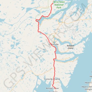
Mallorytown - Arnold's Cove
#Bike #Mallorytown #ArnoldsCove #Newfoundland
- Distance: 118.7 Km
- Elevation gain: 1,182 m
- Maximum elevation: 149 m
- Elevation loss: 1,171 m
- Minimum elevation: 8 m
Interactive map
GPS track profile
About this GPS track
Name: Mallorytown - Arnold's Cove GPS track, route, trail
Start: Newfoundland, Newfoundland and Labrador, Canada (48.54387 -53.97440)
Coordinates: 47.75619 -54.20892 48.54387 -53.93189
Other GPS tracks
Click on a GPS track to view route, its statistics and profile.
Arnold's Cove - Whitbourne
Canada > Newfoundland and Labrador
#Bike #ArnoldsCove #Whitbourne #Newfoundland
Distance: 50.5 Km • Elevation gain: 719 m • Maximum elevation: 199 m