Mont-Tremblant
Randonnée en boucle depuis Mont-Tremblant. #Randonnée #Boucle
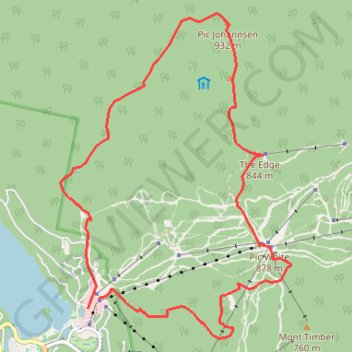
- Distance: 15.1 Km
- Elevation gain: 798 m
- Maximum elevation: 923 m
- Elevation loss: 812 m
- Minimum elevation: 245 m
- Moving time: 5 h 56 m
- Moving speed: 2.5 Km/h
- Maximum speed: 5.1 Km/h
- Total time: 6 h 31 m
- Global speed: 2.3 Km/h
- Date: Saturday, 01 October, 2011
Interactive map
GPS track profile
About this GPS track
Name: Mont-Tremblant GPS track, route, trail
Coordinates: 46.20810 -74.59111 46.25008 -74.54806
Other GPS tracks
Click on a GPS track to view route, its statistics and profile.
Mont-Tremblant - Lac Nominingue - Lac Saguay
Canada > Québec > Les Laurentides > Mont-Tremblant
#Vélo
Distance: 158.6 Km • Elevation gain: 807 m • Maximum elevation: 330 m