SICILE - PEDESTRE - Îles Éoliennes - Stromboli - Ascension du volcan
Randonnée en boucle depuis Stromboli. #Randonnée #Boucle
- Distance: 8.0 Km
- Elevation gain: 873 m
- Maximum elevation: 904 m
- Elevation loss: 880 m
- Minimum elevation: 31 m
- Moving time: 3 h 41 m
- Moving speed: 2.2 Km/h
- Maximum speed: 4.9 Km/h
- Total time: 5 h 18 m
- Global speed: 1.5 Km/h
- Date: Wednesday, 11 September, 2013
Interactive map
GPS track profile
About this GPS track
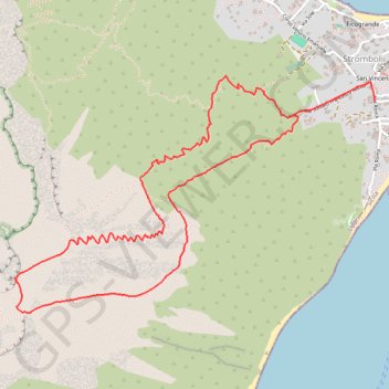
Name: SICILE - PEDESTRE - Îles Éoliennes - Stromboli - Ascension du volcan GPS track, route, trail
Start: Via Roma, San Vincenzo, Stromboli, Lipari, Messine, Sicile, 98050, Italie (38.80250 15.23799)
End: Via Roma, San Vincenzo, Stromboli, Lipari, Messine, Sicile, 98050, Italie (38.80175 15.23816)
Coordinates: 38.79052 15.21368 38.80309 15.23819
Other GPS tracks
Click on a GPS track to view route, its statistics and profile.
Terdav - Eoliennes - J4 - Transfert de Vulcano à Stromboli
Italie > Sicile > Messine > Lipari > Vulcano Porto
Randonnée entre Vulcano Porto et Stromboli. #Randonnée
Distance: 74.1 Km • Elevation gain: 7 m • Maximum elevation: 6 m