Tanawan Falls
- Distance: 0.3 Km
- Elevation gain: 19 m
- Maximum elevation: 373 m
- Elevation loss: 1 m
- Minimum elevation: 354 m
- Moving time: 7 m 17 s
- Moving speed: 2.5 Km/h
- Maximum speed: 5.8 Km/h
- Total time: 12 m 50 s
- Global speed: 1.4 Km/h
- Date: Sunday, 21 April, 2024
Interactive map
GPS track profile
About this GPS track
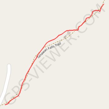
Name: Tanawan Falls GPS track, route, trail
Start: Tanawan Falls Trail, Tanawan, Aurora, Central Luzon, 3131, Philippines (15.41714 121.37624)
End: Tanawan Falls Trail, Tanawan, Aurora, Central Luzon, 3131, Philippines (15.41892 121.37805)
Coordinates: 15.41714 121.37624 15.41892 121.37805
Topography: Aurora topographic map