N4
- Distance: 9.7 Km
- Elevation gain: 233 m
- Maximum elevation: 1,315 m
- Elevation loss: 1,220 m
- Minimum elevation: 223 m
Interactive map
GPS track profile
About this GPS track
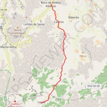
Name: N4 GPS track, route, trail
Start: EN3-SA-08, Lin d' Corvo, Espongeiro, Porto Novo, 1310, Cap-Vert (17.08669 -25.13817)
End: Boca de Ambas Ribeiras, Ribeira Grande, 1139, Cap-Vert (17.15170 -25.13106)
Coordinates: 17.08669 -25.13817 17.15170 -25.12078
Other GPS tracks
Click on a GPS track to view route, its statistics and profile.
N1BIS_11KM
Cap-Vert > Ribeira Grande > Coculi
Distance: 11.5 Km • Elevation gain: 636 m • Maximum elevation: 978 m
Cha de Igreja - Cha de Pedras
Cap-Vert > Ribeira Grande > Chã de Igreja
Randonnée pédestre. En aller simple. #Randonnée
Distance: 7.1 Km • Elevation gain: 876 m • Maximum elevation: 733 m