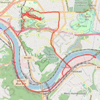
Schenley Park and Monongahela River Loop
Loop hike through Schenley Park and along Monongahela River. #Hike #Loop #Nature #City #Park #Forest #River
- Distance: 28.2 Km
- Elevation gain: 395 m
- Maximum elevation: 340 m
- Elevation loss: 395 m
- Minimum elevation: 219 m
- Moving time: 4 h 32 m
- Moving speed: 6.2 Km/h
- Maximum speed: 20.6 Km/h
- Total time: 4 h 34 m
- Global speed: 6.2 Km/h
- Date: Sunday, 18 April, 2021
Interactive map
GPS track profile
About this GPS track
Name: Schenley Park and Monongahela River Loop GPS track, route, trail
Coordinates: 40.39477 -79.96238 40.44020 -79.89656
Other GPS tracks
Click on a GPS track to view route, its statistics and profile.