Stirling
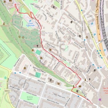
Walk from the city center to the castle. #Walk #City #Castle
- Distance: 1.4 Km
- Elevation gain: 68 m
- Maximum elevation: 93 m
- Elevation loss: 2 m
- Minimum elevation: 25 m
- Moving time: 28 m 23 s
- Moving speed: 3.0 Km/h
- Maximum speed: 8.8 Km/h
- Total time: 43 m 3 s
- Global speed: 2.0 Km/h
- Date: Sunday, 11 February, 2024
Interactive map
GPS track profile
About this GPS track
Name: Stirling GPS track, route, trail
Coordinates: 56.11668 -3.94738 56.12377 -3.93746
Other GPS tracks
Click on a GPS track to view route, its statistics and profile.
United Kingdom to Beinglas Campsite
Royaume-Uni > Écosse > Dumfries and Galloway
Distance: 215.4 Km • Elevation gain: 1,837 m • Maximum elevation: 318 m