Mon parcours
- Distance: 36.1 Km
- Elevation gain: 909 m
- Maximum elevation: 725 m
- Elevation loss: 1,153 m
- Minimum elevation: 313 m
Interactive map
GPS track profile
About this GPS track
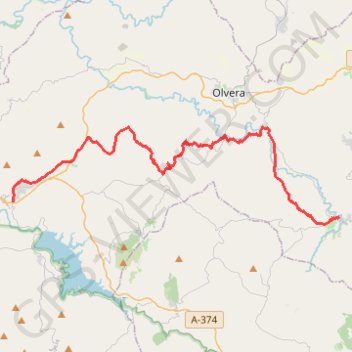
Name: Mon parcours GPS track, route, trail
Coordinates: 36.85968 -5.41009 36.91435 -5.18139
Other GPS tracks
Click on a GPS track to view route, its statistics and profile.
Southern Section — European Divide Trail
Espagne > Andalousie > Cazorla
Distance: 830.4 Km • Elevation gain: 19,253 m • Maximum elevation: 2,134 m
Vila do Bispo -> Distrito 4 (495,2 km)
Distance: 1,306.4 Km • Elevation gain: 23,128 m • Maximum elevation: 2,134 m