Trail Planner Map
- Distance: 5.7 Km
- Elevation gain: 570 m
- Maximum elevation: 546 m
- Elevation loss: 570 m
- Minimum elevation: 5 m
Interactive map
GPS track profile
About this GPS track
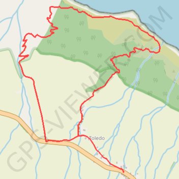
Name: Trail Planner Map GPS track, route, trail
Start: ER 1-2, Toledo, Santo Amaro, Velas, Açores, 9800-501, Portugal (38.69444 -28.14493)
End: ER 1-2, Toledo, Santo Amaro, Velas, Açores, 9800-501, Portugal (38.69445 -28.14496)
Coordinates: 38.69442 -28.15472 38.70644 -28.14158